VIEW3D
Earth models are derived from a combination of redundant seismic data, borehole data, and interpreter intuition. The VIEW3D module can produce complex geologically consistent models in a straightforward manner. This module includes the technology to:
- visualize data in three dimensions, including interpreted horizons and 2D lines as a function of CDP, line and offset;
- construct complex geologically consistent Earth models from well log data and interpreted horizons;
- integrate borehole data into the seismic imaging process using either statistical or horizon=based projection.
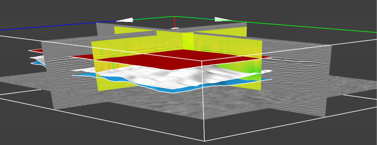
This image shows a horizon-based density and surface dip displayed inside a data volume.